Geophysical data acquisition has been completed for the Géoscan Arc project which aims to evaluate the potential geothermal resources in southeastern France, around the Étang de Berre. This data is now being processed and will be supplemented with data from other geoscientific studies towards a presentation of integrated results before the summer of 2025.
This project is sponsored by the ADEME agency and the BRGM, with financial support from the Région Sud, Département des Bouches du Rhône, and the Aix-Marseille-Provence metropole.
Geothermal beyond Paris
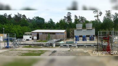
As of 2023, France has 80 deep geothermal plants producing 2 TWh of heat. Most of these operations are taking place in the Paris Basin and in the Aquitaine Basin, with none in southeastern France, despite its potential geothermal resources and the demand for decarbonized heat for both residential heating networks and industry use.
Therefore, to foster the development of deep geothermal project in southeastern France, an exploration campaign was started targeting approximately 1000 km2 area around the Etang de Berre.
The area is well known for its lignite resources and has also been explored, without success, for oil and gas (exploration wells and seismic data shot before 1980). Despite the geoscientific data available, significant uncertainties remain regarding the existence and characteristics of a deep geothermal resource. The main unknowns include the geometry and depth of the target reservoirs (carbonates from the lower cretaceous), properties of the reservoirs and characteristics of the water resource (presence, recharge dynamics and exit mechanism).
A comprehensive exploration program
To help assess these elements and uncertainties a comprehensive exploration program was drafted and is currently being executed.
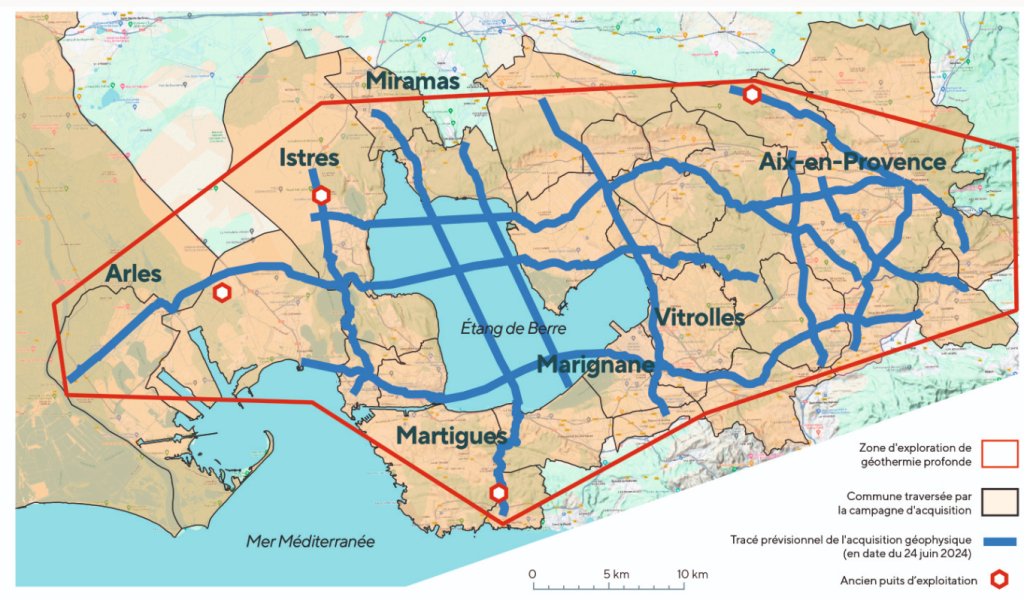
It started with the acquisition in autumn 2024 of over 320 km of modern broadband 2D reflection seismic data on land and on the Etang de Berre to complement the legacy and help with the construction of structural model of the zone of interest. This geophysical campaign – financed by public funds – is referenced in the article of “La gazette des communes”.
To complement the geophysics, geological field work to collect structural information and rock samples from analogues as well as a study of the karstification is being undertaken now. The collected data will help with understanding of the reservoir properties and possible fluid flow circulation at depth. The construction of a geological model integrating all the data will take place by the end of the year with an expected end of the project and result delivery to the public, authorities and industry by mid 2026.
Source: Email correspondence